
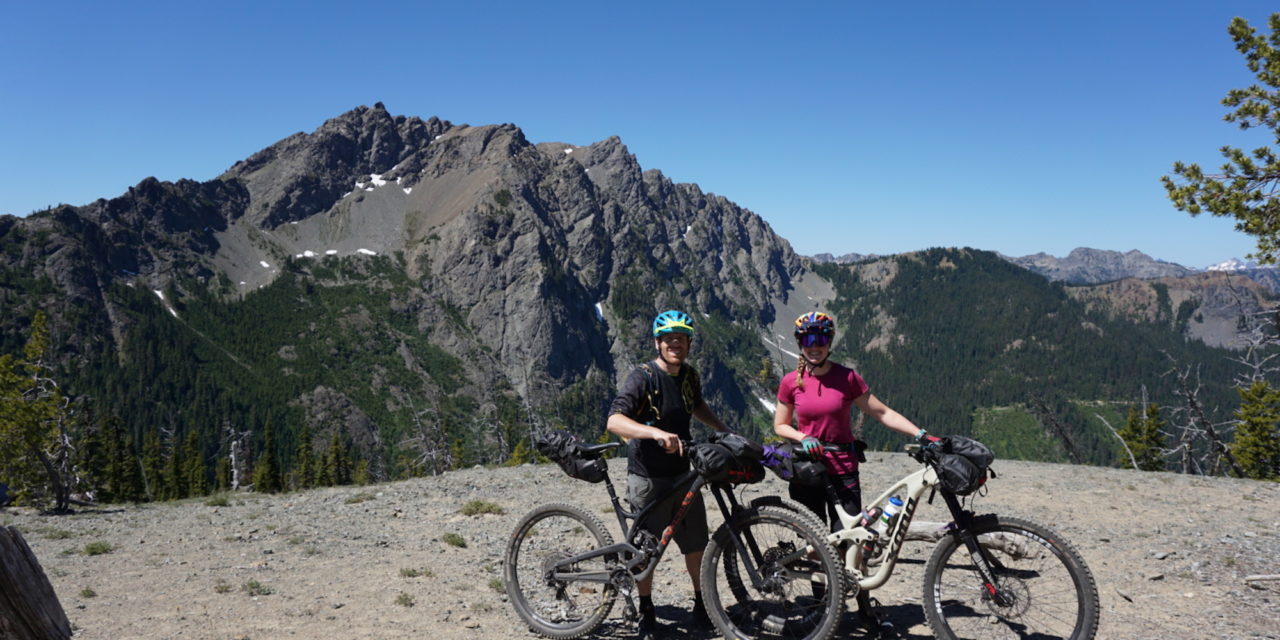
Words by Kona Ambassador Delia Massey. Photos by Kinsey Smith
Bikepacking seems like such a great idea, until it’s 3pm on a Sunday and you’ve been pushing your loaded bike straight up a moto trail in the middle of nowhere for over an hour looking for a hiking trail that both Trailforks and the topo map says exists but does not, in fact, exist and therefore the planned route back to your car does not exist.
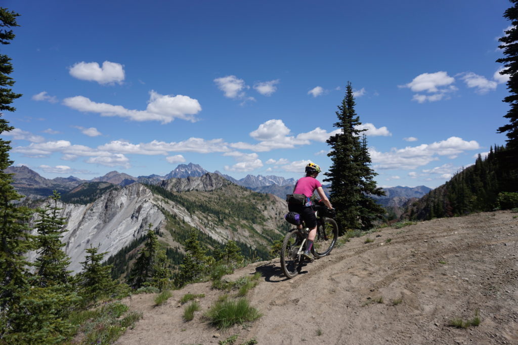
Let me back up a minute and explain how I got myself in this predicament. I’m an experienced cyclist and I’ve been on a number of bikepacking trips, so I consider myself fully competent when it comes to choosing gear, packing my bike, and following a route. I had always used existing routes, though, and had never planned out a route all by myself on unknown trails. I had heard that there was some riding out near Jolly Mountain in the Teanaway region, so I decided that would be the perfect place to create my own route. I diligently did my research, looking at Trailforks, local mountain bike forums, and topo maps. I pieced together my route based on this information and with the goal of making a loop that would be long enough to provide two full days of riding but not so ambitious that we couldn’t finish. The final route was about 43 miles and 12,500 feet of climbing and was mostly singletrack moto trails with some fire roads and hiking trails thrown in. Ok, maybe it was a little ambitious!
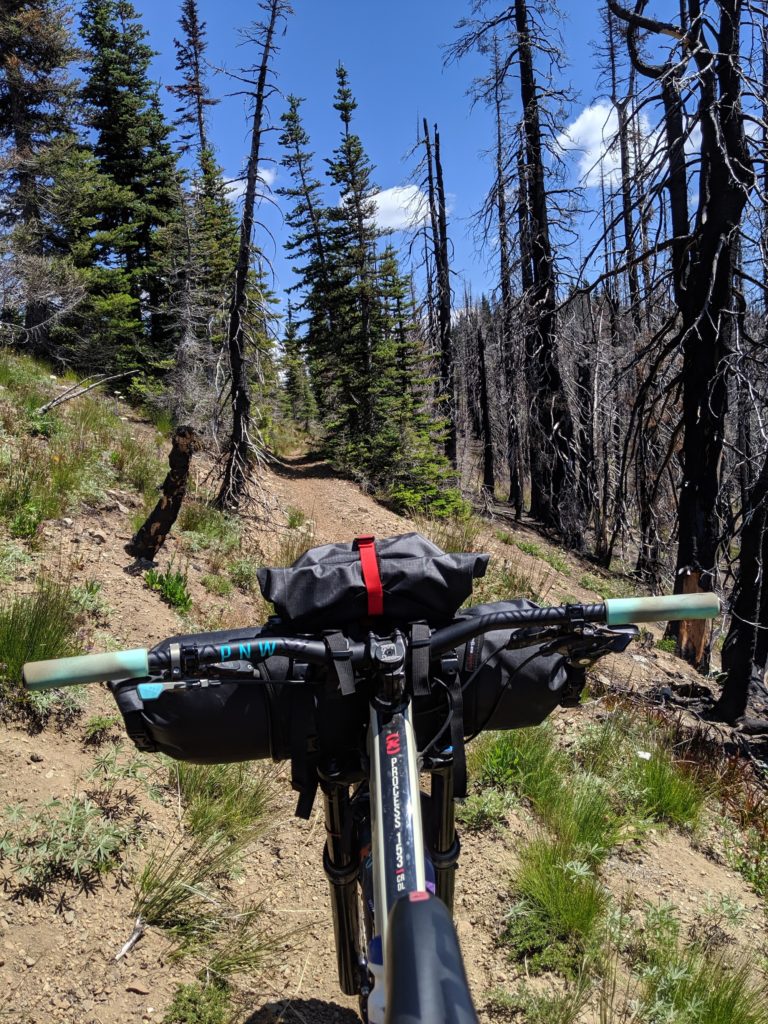
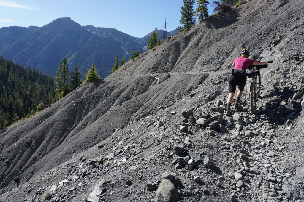
My adventure partner, Kinsey, trusted my judgment and agreed to my self-described death march. We chose a sunny weekend in July and set off on the journey. The first climb up the Jolly Mountain access road took much longer than I thought it would, but I figured we would move faster when we hit trail. I was wrong. The moto trails were loose, dry, rocky, and difficult to pedal up, which was only made harder with the pounds of gear we had strapped on our handlebars and seatposts. I quickly reassessed my plan for Day 1 and skipped the out and back I had planned up to the summit of Jolly Mountain, and planned to camp at an earlier mileage.
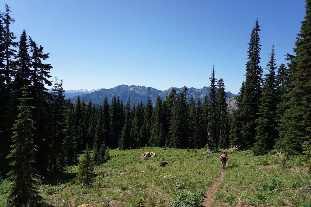
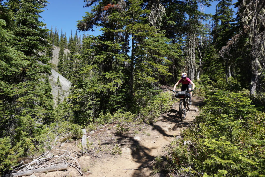
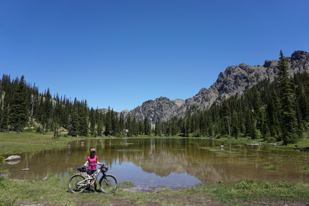
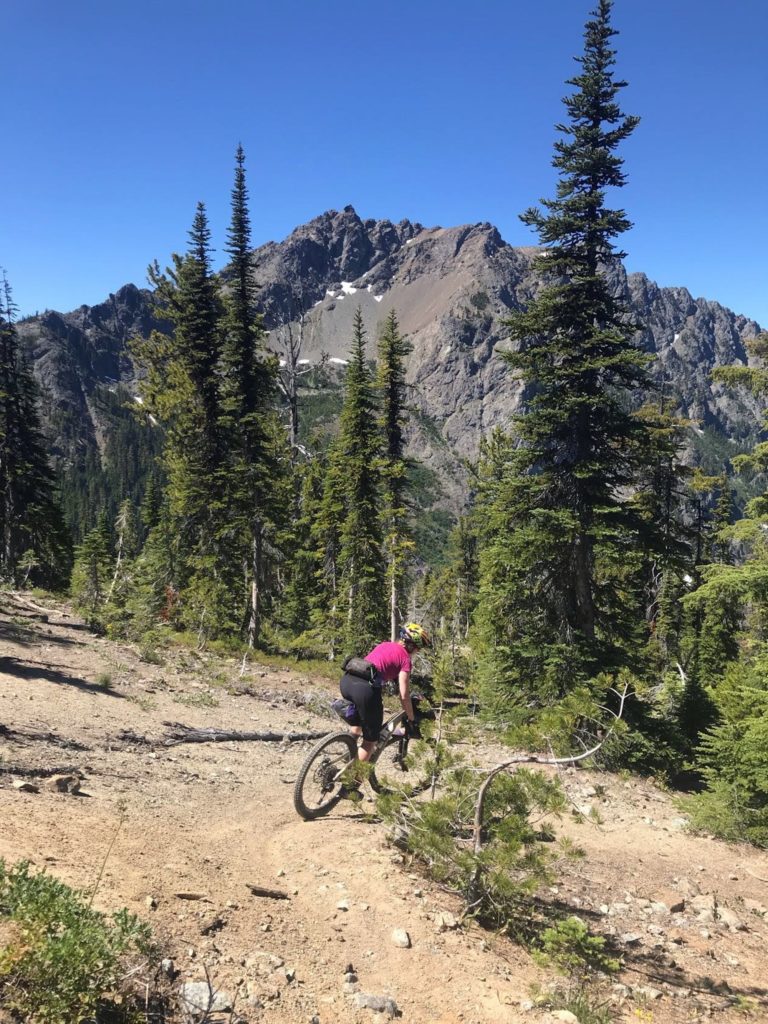
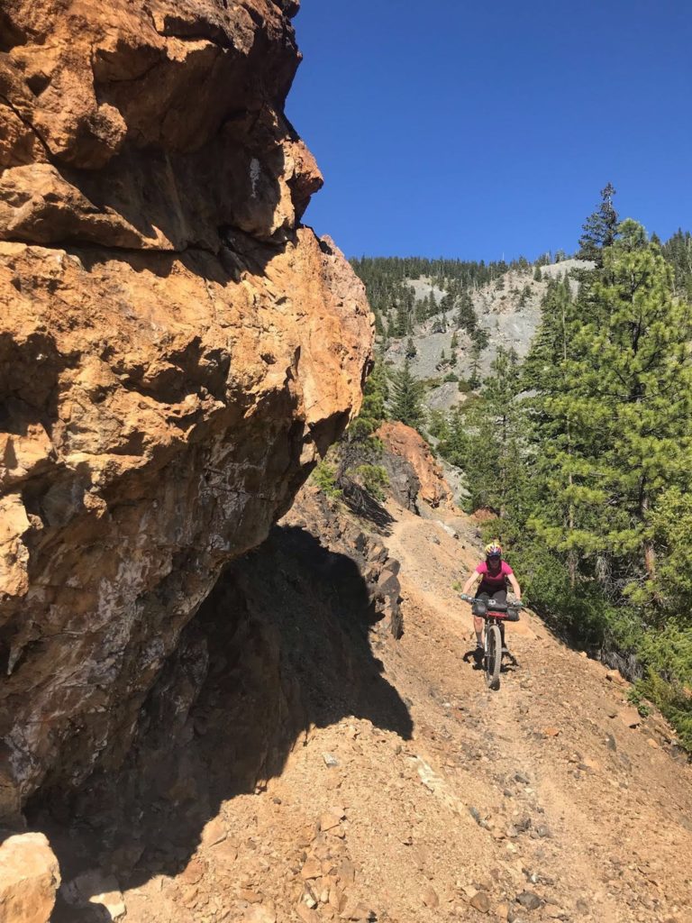
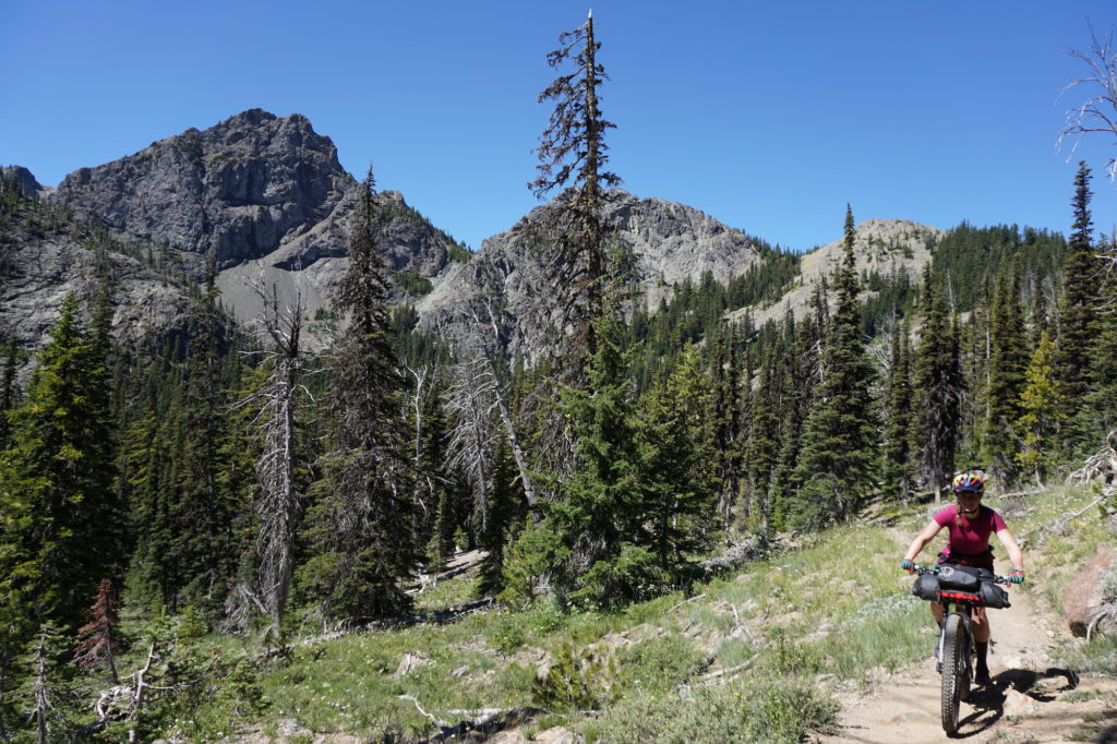
We rode down steep sections of trail with exciting exposure, bushwhacked through overgrown sections, climbed over trees, and met moto riders who were shocked to see some crazy mountain bikers on their trails. The views were spectacular, with the clear day giving us an unreal panorama of the North Cascades in every direction. There was plenty of water from the numerous creek crossings along the way, and we found fat strawberries to snack on. We reached our camp spot by dinner time and took a dip in the creek to wash the dust and sweat off. We had covered 20 miles, which was a solid day, but we still had another 23 miles to cover on Day 2. As we started out slowly the next morning, I made the call to cut out another section of the ride, thinking that would make the remaining mileage do-able. We made slow but steady progress and had our lunch next to a pristine alpine lake.
After the lake, there was a moto trail that was supposed to take us straight up and over a ridge. The trail was not there. We continued riding and ran into the trailhead further down, not where it was marked on the map. But it was there, so up we went. This was our first sign of trouble. We started pushing up the trail because it was far too steep to ride. We reached what was supposed to be the intersection with the hiking trail that would take us back toward the car…and it wasn’t there. Kinsey headed into the woods, following his GPS along the supposed trail, and found a few faint remnants of it. The trail had been abandoned and was not passable with our loaded bikes and tired legs. I recall sitting at the side of the moto trail feeling absolutely defeated like the trip was a failure. Minutes crawled by while I looked at my map and panicked, unsure if we would make it out before dark. Either we continued to push up looking for another way back over the ridge, or we bailed on the planned route and turned around to go back down the trail we were on, which connected with another moto trail that would take us out to the fire road and eventually back to our car. I decided the safest option was to turn around and give up on my route. We got back to the car with enough time to swim in Cle Elum Lake and get burgers for dinner.
The trip may not have gone quite as planned, but it was certainly not a failure. We rode bikes through beautiful scenery for two days and got to push our limits on a loop that I don’t think anyone else has ever attempted. There was no way I could have known that the trail wouldn’t be there, that was completely out of my control. When the time came to quit, I knew it was the right choice and it got us safely out of the wilderness.

You must be logged in to post a comment.